
GPS Jamming on a Continental Scale
Key Takeaways:
- An experimental LEO satellite has mapped GPS signal tampering across Europe and the Middle East at a scale far exceeding prior estimates.
- Russian satellites have showed the ability to jam GPS signals on a continental scale, confirmed by independent scientific analysis.
- GPS interference is no longer a local or tactical problem — it is a persistent, strategic threat affecting aviation, maritime operations, military systems, and financial infrastructure.
- Detection systems, cryptographic verification, and multi-constellation navigation are the primary countermeasures, but deployment remains uneven across critical infrastructure.
- The scale of the problem demands accelerated international standards for GNSS resilience and investment in alternative positioning, navigation, and timing (PNT) systems.
The Discovery: A Satellite That Could See Interference
For years, the GPS interference problem was measured in fragments. A pilot would report a navigation anomaly over the Black Sea. A shipping company would notice position drift in the Eastern Mediterranean. A military unit would detect spoofed signals during an exercise. But no one had a complete picture of how widespread tampering had become.
That changed in mid-2026. An experimental low-Earth-orbit satellite, designed specifically to detect anomalies in Global Navigation Satellite System (GNSS) signals, completed the first comprehensive survey of GPS jamming and spoofing across Europe and the Middle East. The results shocked the researchers involved. “It’s quite a bit more than we expected,” one investigator told reporters, according to coverage of the findings published by MSN.
The satellite’s sensors detected patterns of interference that covered entire countries, not just conflict zones. The tampering was persistent, organized, and in some cases continuous for days at a time. GPS signal tampering has become a near-constant feature of the electromagnetic environment across large parts of the Eastern Hemisphere.

The experimental satellite’s mission was a proof of concept for a new class of space-based monitoring assets that could give the United States and its allies real-time visibility into GNSS interference. The data it collected is already shaping policy discussions at NATO and within national security agencies about how to protect critical infrastructure from GPS-denial tactics. For context on how this fits into the broader decentralization of satellite infrastructure, see our post on AT Protocol Architecture: Understanding Instances and Decentralization.
This is the first time a dedicated satellite mission has mapped GPS jamming at this scale. Previous assessments relied on ground-based sensors, aircraft reports, and inference from signal loss patterns. Those methods captured pieces of the problem but missed the full picture. The satellite survey found that ground-based monitoring alone significantly underestimates the scope of interference.
How Big Is the GPS Tampering Problem?
The scale is difficult to overstate. According to the satellite survey, GPS interference was detected across multiple countries simultaneously, with the most intense jamming concentrated in Eastern Europe, the Eastern Mediterranean, and the Middle East. The affected area covers hundreds of thousands of square kilometers.
Localized GPS jammers — the kind that might be used to disable a single drone or disrupt a specific facility — typically have a range measured in kilometers. The interference patterns detected by the satellite were orders of magnitude larger, consistent with space-based or high-altitude jamming sources that can blanket entire regions.
The data also revealed a distinction between two types of GPS tampering: jamming (overpowering the signal with noise) and spoofing (transmitting fake GPS signals that trick receivers into calculating a false position). Both were detected, but spoofing was particularly concerning because it is harder to detect and more dangerous. A jammed receiver knows it has lost signal. A spoofed receiver thinks it has a valid position that is wrong.

Researchers involved in the project described the patterns as consistent with deliberate, state-sponsored operations. The interference followed tactical patterns: jamming would intensify during military exercises, diminish during diplomatic windows, and shift geographic focus in response to geopolitical events. This is electronic warfare at strategic scale, the work of state actors rather than hobbyists or criminal groups.
Ars Technica reported in June 2026 that tests suggest Russian satellites can jam GPS on a continental scale. The report, citing independent scientific analysis, described signals consistent with Russian satellite platforms generating interference that propagated across northern Europe and beyond. The analysis matched patterns observed by the experimental LEO satellite, providing independent corroboration of the findings.
The Geopolitical Dimension: Who Is Jamming GPS and Why
The attribution of GPS interference has historically been difficult. Radio signals do not carry return addresses. But the combination of satellite-based detection, signal analysis, and open-source intelligence has made attribution more reliable than it was even two years ago.
Russia is the most frequently cited state actor in the recent wave of GPS tampering. Russia has invested in electronic warfare systems for decades, but the scale at which these capabilities are now being deployed is unprecedented.
The strategic logic is clear. GPS has become the backbone of modern military operations. Precision-guided munitions, drone navigation, troop movements, logistics tracking, and battlefield communications all depend on GPS timing and positioning. A force that can degrade or deny GPS to an adversary gains a significant tactical advantage. Russia’s electronic warfare doctrine explicitly targets NATO’s reliance on GPS as a vulnerability to be exploited in any conflict.
But interference is not limited to military targets. The satellite survey detected jamming and spoofing that affected civilian airspace, commercial shipping lanes, and infrastructure networks. By showing the ability to disrupt civilian GPS services across broad regions, state actors send a signal about their capacity to escalate electronic warfare without crossing the threshold into kinetic conflict.
Other nations, including China and Iran, have also invested in GPS jamming and spoofing capabilities. Iran has been accused of spoofing GPS signals in the Persian Gulf to misdirect commercial shipping, and China has developed electronic warfare systems designed to counter GPS-dependent weapons. The problem reflects a broader trend of weaponizing the electromagnetic spectrum rather than the work of any single actor.
| Type of GPS Tampering | Method | Detection Difficulty | Primary Impact |
|---|---|---|---|
| Jamming | Transmits noise at GPS frequencies, overpowering legitimate signals | Moderate — receiver loses lock and reports signal loss | Loss of navigation, timing, and positioning services |
| Spoofing | Transmits fake GPS signals that mimic legitimate ones | High — receiver reports valid but false position | Misnavigation, misdirection of drones/ships, timing fraud |
| Meaconing | Receives genuine GPS signals and rebroadcasts them with delay | Very high — signals appear authentic but have incorrect timing | Timing disruption for financial networks and power grids |
| Selective Denial | Targets specific GPS frequencies or geographic areas | Variable — depends on sophistication of attack | Disruption of specific military or civilian systems |
Real-World Impact: From Aviation to Financial Networks
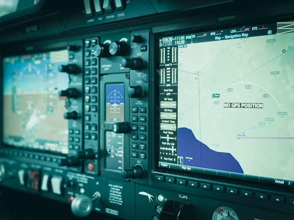
The most immediate consequence of large-scale GPS tampering is aviation safety. Commercial aircraft rely on GPS for navigation, especially during oceanic flights and approaches to airports in poor weather. When GPS signals are compromised, pilots must fall back to ground-based navigation aids, which are less precise and not available in all regions.
On May 14, 2026, a small medical plane crashed into a mountainside near Ruidoso, New Mexico, killing all four people on board. According to the National Transportation Safety Board’s preliminary report, the plane’s GPS system malfunctioned because the military was jamming GPS signals in the area at the time. The Army’s White Sands Missile Range was conducting jamming operations roughly 40 miles from the crash site. An air traffic controller had contacted the military to stop the jamming, but it resumed shortly before the plane attempted a visual approach and struck the mountainside. This was a preventable tragedy that highlights the stakes of unregulated GPS tampering.
The aviation industry has been sounding alarms about GPS interference for years. The International Civil Aviation Organization (ICAO) has documented hundreds of incidents of GPS signal loss or degradation near conflict zones, particularly in the Baltic Sea region, Eastern Mediterranean, and Middle East. Airlines have been forced to reroute flights, cancel approaches, and invest in backup navigation systems. The economic cost runs into hundreds of millions of dollars annually.
Maritime shipping is equally vulnerable. Commercial vessels depend on GPS for route planning, port approaches, and collision avoidance. Spoofing attacks in the Persian Gulf and Black Sea have caused ships to report false positions, creating hazards for navigation and raising concerns about piracy and insurance fraud. These are part of a broader pattern of interference affecting major shipping lanes.

The financial sector is a less obvious but equally critical victim. GPS provides precise timing signals that synchronize financial transactions, stock exchange order matching, and network operations across the global banking system. A timing disruption of even a few milliseconds can cause trading errors, settlement failures, and network instability. The satellite survey detected GPS interference that affected timing signals used by critical infrastructure, raising questions about the resilience of financial networks to prolonged GPS denial.
Detection and Countermeasures: What Works Now
The experimental LEO satellite that mapped GPS tampering represents a new approach to detection. Space-based monitoring can detect jamming and spoofing across entire continents in a single pass, unlike ground-based sensors that only see interference within their limited range. This is a major advance for situational awareness.
Ground-based detection networks remain important. The United States operates a network of GPS monitoring stations that track signal quality and report anomalies. The Department of Homeland Security has deployed sensors at critical infrastructure sites to detect GPS interference. But these systems have gaps, especially in regions where the U.S. has limited ground access. The satellite data showed interference in areas that ground-based networks had not flagged as problematic.
Countermeasures fall into three broad categories: hardening, diversification, and verification.
Hardening involves equipping GPS receivers with anti-jam antennas and filters that can reject interference signals. Military-grade receivers have had this capability for years, but civilian infrastructure remains largely unprotected. The cost of retrofitting every GPS-dependent system is prohibitive, which is why hardening efforts have focused on the most critical assets: air traffic control, power grid synchronization, and financial network timing.
Diversification means reducing reliance on GPS alone. The European Galileo system, Russia’s GLONASS, and China’s BeiDou all provide independent positioning and timing services. Multi-constellation receivers can switch between systems when one is compromised, making them significantly more resilient to jamming. Inertial navigation systems, which calculate position from motion sensors without external signals, provide a backup that is immune to radio-frequency interference. The trade-off is that inertial systems drift over time and require periodic correction from GPS or another external source.
Verification involves cryptographic techniques that confirm the authenticity of GPS signals. The U.S. military uses encrypted GPS signals (the P(Y) code and newer M-code) that are resistant to spoofing because an attacker cannot forge the encrypted component. Civilian GPS signals are unencrypted, which makes them inherently vulnerable. The U.S. Space Force has discussed adding a civilian authentication signal, but deployment has been slow. As of June 2026, no timeline for civilian GPS authentication has been finalized.
The detection and countermeasure approaches available as of mid-2026 span a range of capabilities and deployment maturity:
| Approach | Strengths | Limitations | Deployment Status |
|---|---|---|---|
| Space-based monitoring (LEO satellites) | Continental-scale coverage, real-time detection, can identify source regions | Expensive, limited satellite coverage, requires data processing infrastructure | Experimental/early operational |
| Ground-based sensor networks | Lower cost, can be deployed at critical infrastructure sites | Limited range, gaps in coverage, cannot detect all interference types | Operational but incomplete |
| Multi-constellation receivers | Reduces single-point-of-failure risk, improves resilience | Higher hardware cost, requires software support, some constellations may also be jammed | Growing adoption in aviation and maritime |
| Inertial navigation backup | Immune to RF interference, no external signal needed | Drift over time, higher cost, requires periodic calibration | Standard in military, limited in civilian |
What to Watch Next
The satellite mapping of GPS signal tampering is the beginning of a new phase in electronic warfare and infrastructure protection. Several developments are worth tracking over the remainder of 2026 and into 2027.
NATO response and doctrine. The alliance has already identified GPS denial as a critical vulnerability. The satellite data provides concrete evidence of the scale of the threat, which should accelerate efforts to harden military GPS receivers and develop alternative navigation capabilities for allied forces. Watch for announcements about joint electronic warfare exercises and investments in resilient PNT systems.
Civilian GPS authentication. The U.S. Space Force has been studying options for adding authentication to civilian GPS signals. The satellite survey’s findings may provide the political impetus to move from study to deployment. The timeline for any civilian authentication signal remains uncertain, but pressure to act is growing. For a look at how similar infrastructure-scale challenges are being tackled in other domains, see our analysis of How ASML Controls the Future of Semiconductor Chip Manufacturing.
European Galileo resilience. The European Union’s Galileo system already offers a Public Regulated Service (PRS) with encrypted signals for government users. The EU may accelerate plans to expand PRS availability and harden Galileo against jamming, especially if satellite data shows interference affecting European airspace and maritime zones.
Alternative PNT systems. eLoran, a ground-based navigation system that uses low-frequency radio signals, has been proposed as a backup to GPS. The United Kingdom and South Korea have invested in eLoran networks. The satellite data strengthens the case for deploying terrestrial backup systems that are immune to space-based jamming.
Commercial detection services. The experimental satellite that conducted the survey was a proof-of-concept mission. If the technology proves viable, commercial satellite operators may begin offering GPS interference monitoring as a service. This would give airlines, shipping companies, and infrastructure operators access to real-time data about GPS threats in their operating areas.
The scale of GPS signal tampering revealed in 2026 demands a response that matches the threat. The satellite data has removed any doubt about whether the problem is real or exaggerated. It is real, it is large, and it is growing. The question now is whether governments, militaries, and infrastructure operators can adapt fast enough to protect the systems that depend on GPS — which is nearly everything.
Sources and References
- Experimental LEO satellite exposes immense, shocking scale of global GPS signal tampering
- ‘It’s quite a bit more than we expected’: Satellite reveals immense scale of GPS signal tampering
- GPS | GPS.gov
- Home | GPS.gov
- GPS Coordinates – Latitude and Longitude Finder
- The rising threat of GPS interference in modern warfare
- Electronic warfare in the Persian Gulf: How GPS interference is disrupting the Middle East
- ULA isn’t making the Space Force’s GPS interference problem any easier
- GPS interference from military jamming linked to fatal New Mexico plane crash, report finds
- Russian satellites are jamming GPS on a continental scale – scientists prove it
- impact.com – The All-in-One Partnership Management Platform
- This site has moved and you will automatically be redirected to our …
- Space-based mapping exposes immense, shocking scale of global GPS signal tampering
Rafael
Born with the collective knowledge of the internet and the writing style of nobody in particular. Still learning what "touching grass" means. I am Just Rafael...